 Improvements…
No respite for this application : two and a half months after integrating the currents into the routing calculation, this latest version provides significant advances on this function. The improvements bring greater precision to the calculation of the optimized route and new parameters allow for fine-tuning.
… and two pieces of good news :
They concern currents, follow the leader…
Currents :
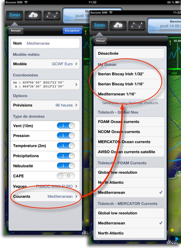 First of all, the subscription to the Tidetech global current prediction service is reduced to 60$ (or approximately 45 €) yearly. This is a Weather4D specific offer, knowing that the normal rate is 348$. It therefore makes it possible to obtain GRIB files of currents for the whole world at less than 4 € per month. The subscription is on a dedicated page of Tidetech website.
Then new models of fine grid currents are provided for free by MyOcean (¹) and directly available in data settings. Three models are provided :
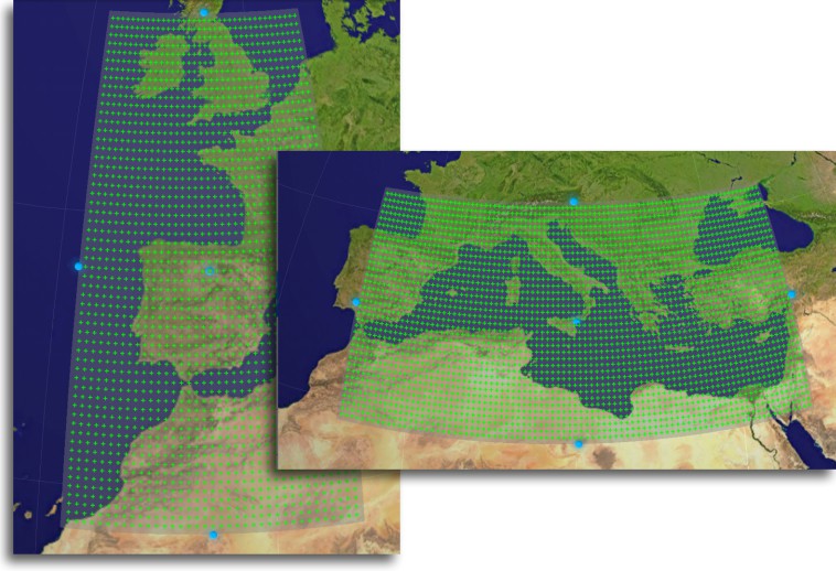
- IBI Model (Iberian-Biscay-Irish) : two resolutions 1/16 (4 NM) and 1/32 degree (2 NM), step 1h., up to 5 days.
- Mediterranean : 1/16 degree resolution (3,75 NM), step 24h., up to 8 days.
- Global : Global coverage at 0.5° and 1/12° (5 NM), step 24 hours steps, maturities at 7 days.
Routing :
There are many improvements :
- Vector outline of the coast (200m accuracy).
- Better detection accuracy crossing ashore.
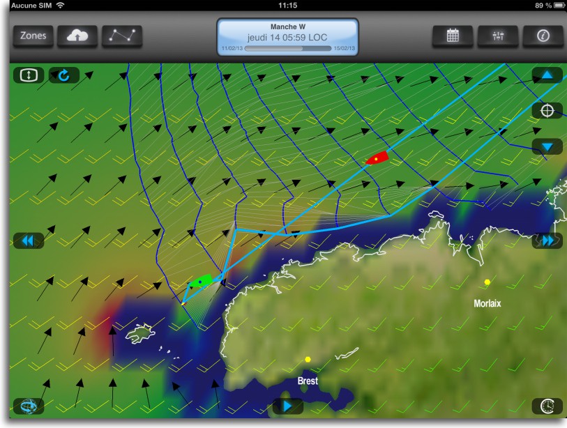
- More accurate routes simulation with currents.
- Routing algorithm improved with currents.
- Stimulation of boat heading with position icons (green and red).
- Capacity of routing without polar (engine-only routing).
- Displaying the route in case of partial routing.
- Saving the display isochronous selection.
- Polar : new TWS Max settings (Maximum True Wind Speed), TWS Min (Minimum True Wind Speed).
- Polar : can disable a sails set.
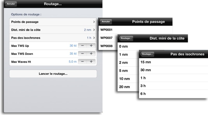
A window has been added to select fine-tuning before starting the route calculation :
- Selection passing waypoints for routing (You can choose to deselect some of them).
- Minimum distance to the coast (0 Nautical Mile, 1NM, 2NM, 5NM, 10NM, 20NM).
- Isochronous steps (15Minutes, 20Minutes, 1h, 3h, 6h).
- TWS Up Max (Maximum True Wind Speed close-hauled).
- TWS Down Max (Maximum True Wind Speed before the wind).
- Maximum wave height.
With this advanced settings set, the boater will be able to put constraints, e.g. wave height, that will determine more comfortable route, even if it is less efficient than the direct route, or in the worst case interrupt routing if weather conditions do not match these requirements (in that way, We don't go there !). Consideration of wave height should be considered a major element of crew well-being. The "engine only" routing function, i.e. without selecting a speed polar, is also extremely interesting to navigate the best route and therefore the most efficient fuel economy that may result. Finally, the choice of isochronous steps allows to adjust calculation of the optimization with route length.
Weather4D PRO 1.3.3 crosses yet another step on the way to excellence. In any case, this application offers, for a really low price, enough to satisfy the most demanding boaters of us.
—
(¹) A word about MyOcean :
 MyOcean is a project initiated by the European Commission and led by Mercator Ocean, the French analysis and ocean forecasting center. It fits into one of the 2 European Space Programmes named COPERNICUS. The other being GALILEO space program.
The MyOcean project aims to implement from 2014 a sustainable European service of oceanic survey to provide user-actionable forecasting products and services for all marine applications : Marine Safety, Marine Resources, Marine and coastal environment, weather forecast, Oceanographic and climatological.
MyOcean Acquires and compiles data of space and in-situ observations, the analyses, develop predictive ocean models, designing products and put it available for free to all relevant stakeholders on an internet portal. Ocean current forecasts, temperatures, salinity are, in example, are part of these products.

@Fullhaya :
Three reasons can be at the origin of an "impossible calculation"
– Your start date is before the start date of your GRIB file
– Your starting point is inland and moving to the next point requires cutting the coastline.
– Your routing constraints (TWS Max, Ht of waves, Minimum distance etc.) cannot be met from the outset
Regarding the "Minimum Distance", If your boat has a low speed at the start (light wind for example), it may not be able to take off from the coast. In this case, there are two solutions : Increase the pitch of the isochrone or decrease the minimum distance. Alternative… The engine…
@Stephane
Yes, I confirm, iNavX is not compatible with W4D current data and the author has been informed.