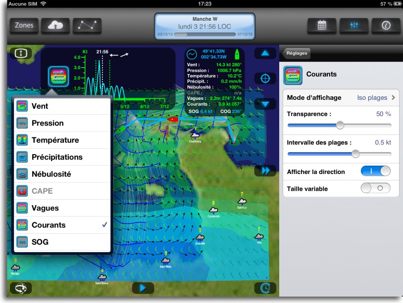
 With the version 1.3.2, Weather4D PRO allows to get and display currents as GRIB data. To begin with, currents available are provided with subscription by Tidetech, I mentioned there in the past (¹). Once entered in Weather4D PRO settings a username and password, provided at the time of subscription, you can access Tidetech global catalog.
Only one PRO subscription to Tidetech allows you to obtain files in GRIB format. The company is considering a specific offer for applications on iPad / iPhone.
The choice of available currents files is fitted to the geographical area defined previously, and GRIB file downloaded after weather file contains only the extraction of data delimited by this area. Ceci permettant d’optimiser la taille du fichier.
For currents data, des unités ont été ajoutées, un réglage spécifique pour l’affichage comme pour les autres données ainsi que le paramètre « Courants » dans le météogramme.
Once the latest file downloaded, à la suite du fichier météo, the module de routage intègre ce paramètre en plus des paramètres de vent et de vagues, in order to calculate the optimized route, comme dans la vidéo ci-dessous :
TideTech prediction relate major ocean currents, and tidal streams in many regions of the world, as the English Channel and the Strait of Gibraltar, in example. Eventually Olivier Bouyssou hopes to integrate SHOM tidal streams for French shores, des discussions sont amorcées.
"Currents" factor, essential to the relevance of routing, pousse encore plus loin la qualité inégalée de cette application.


Bonjour
Est-il possible de reprendre ces fichiers Grib de Courant directement dans Inavx.
Thank you for your answer.
PS : 649$ l’année …c’est pas donné.
Oui. Il suffit de sélectionner le fichier reçu dans l’historique, « Ouvrir dans » iNavX. L’affichage combiné vent + courants est assez sympa. Par contre le défilement automatique fonctionne mal, il faut faire défiler avec le champ de dates déroulant.
Bonjour,
Merci pour ces informations. Est-il possible d’exporter la route calculée par Weather4D vers iNavx ? ou bien faut-il relever les waypoints pour les resaisir par la suite dans iNavx ?
Sincerely,
Conversion of the calculated route to a "normal" route (export to iNavX)