 Weather4D 2.0 is available sur Apple AppStore (*). After the success of the first two versions, APP4NAV company just revisit chart navigation on iPad and iPhone by integrating the timing dimension. With simulations and weather routing, navigation becomes predictive, allowing a constant anticipation of future weather conditions and sea state. This “navigation into the future”, relied on the quality of meteorological and oceanographic predictions today available, was designed in order to bring a new dimension to the safety of boaters.
Navigation
The navigation function is based on the use of a raster charting exclusively from the most important international hydrographic services, as SHOM (¹). This choice is made possible thanks to technology implementation in application to present these charts in tiles with great fluidity. This official charting, having undergone any transformation, is the exact equivalent of publishers paper chart production, and therefore an indisputable guarantee of reliability (²). The maps are subject to a subscription by publisher on the French server Geogarage, which continuously maintains a global portfolio.
 Weather report
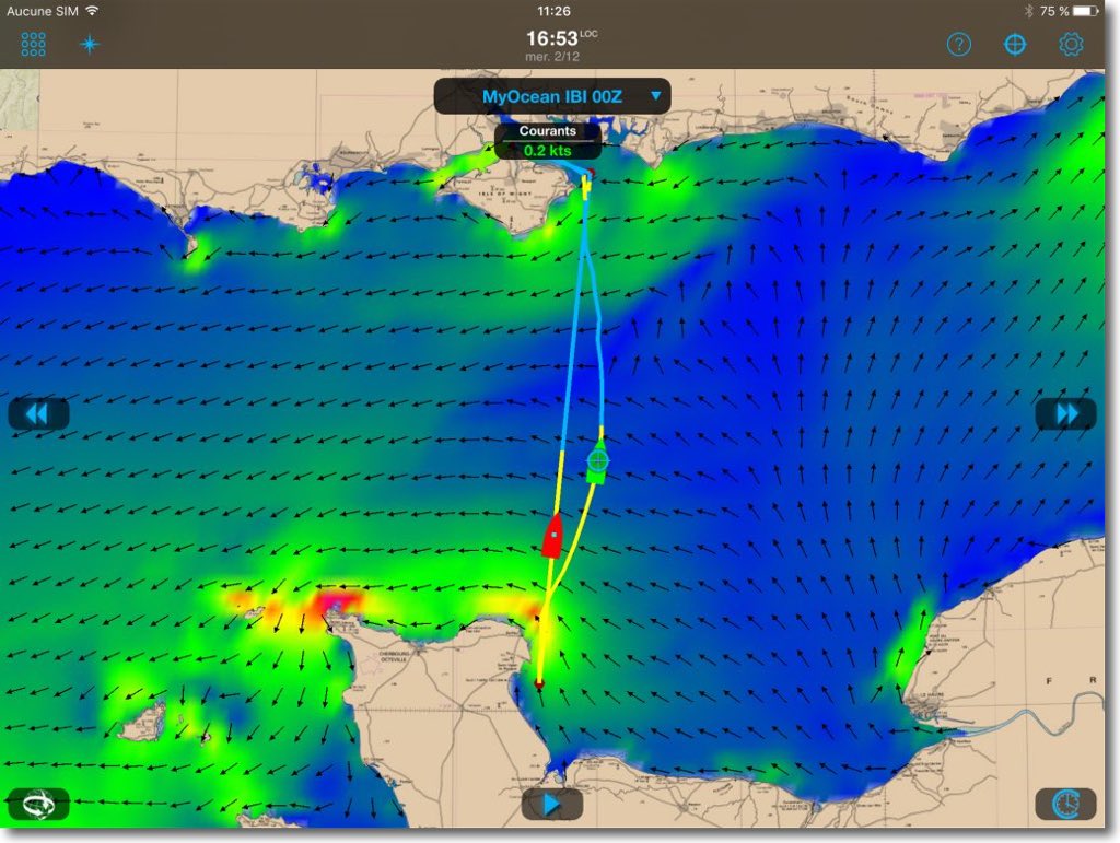
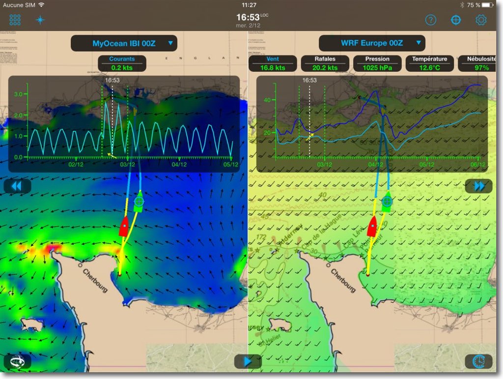
The app offers a completely redesigned ergonomics interface through the accumulated user experience for five years. It takes up the principle of what made Weather4D successful : multiplicity of forecast models, multi-data display overlayed layers, continuous time scrolling automatic or manual , added to high-quality graphic design using Apple's most advanced development tools, facilitate the understanding of future weather phenomena. In addition, navigation and weather forecasts can be displayed in one or two windows (iPad only), offering several display combinations of the same area : navigation and weather, weather forecasts and wave or current forecasts, comparison of different models. Dual windows can be dissociated to display the same area at different scales.
Weather4D 2.0 is supplied as standard with GFS 0.25° global forecasts model. Weather models NAM, COAMPS, WRF (USA), GEM (Canada), ARPEGE, AROMA and AROMA HD (France), as well as WW3 wave and MyOCEAN current models, are provided in a single pack available by annual subscription (in-app purchase). These files are integrated and controlled by APP4NAV and made available on its own servers.
Simulations and routing
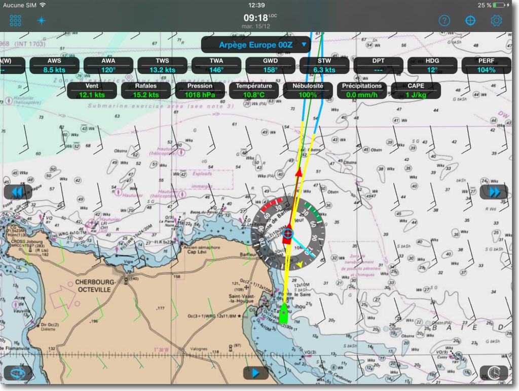
Weather4D 2.0 allows you to simulate future navigations “in an armchair”. The boater can save waypoints, simulate roads, combine to GRIB forecasts models in order to optimize routes in the multi-routing module, compare depending on the options. A fashion navigation, simply follow the best routing result, and compare in real time the conditions supported to weather model predictions using the displayed instruments. Indeed, in navigation mode, instruments display progress information in real time, and can receive data from the external Wi-Fi from onboard devices. Currently browsing, routing can be refreshed at any time from the actual position of the boat.
 And then ?
Weather4D 2.0 supports TCP/IP connections for receiving NMEA data from most navigation systems. In the weeks that followed the publication of the application, will be added the support of AIS, Apple Watch support, an instrument dashboard, tracks management associated with automatic logbook generation, a Saildocs query generator by satellite phone.
No doubt this application will help increase the attractiveness of tablets for navigation, providing a complete solution for responsible boaters, its ease of use, the wealth of information delivered, connectivity allowing constant updates, all features contributing to facilitate decisions of the skipper for the safety and comfort of the crew.
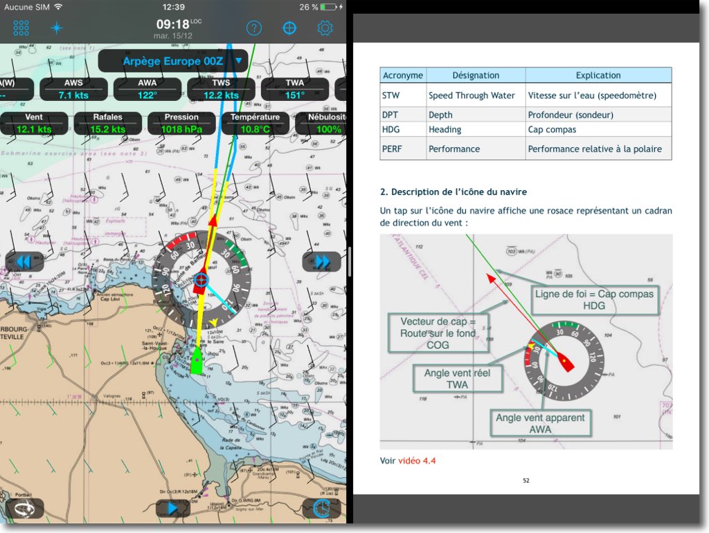
You can download the free user tutorial in French and in English which accompanies the application, including 37 instructional videos. It was designed for use on iPad at the same time application is running thanks to Apple SPLITVIEW function (iPad Air2 and Pro only). Note that Weather4D 2.0 works only from iOS 9.0 and later.
———
(*) Charting subscription is available from Geogarage website with the link :
French : https://weather4d.geogarage.com/fr/
English : https://weather4d.geogarage.com/en/
———
(¹) To date, available publishers are : NOAA (USA), CHS (Canada), WLP (Bahamas), given (Brazil), AS (Argentina), SHOM (France/DOM-TOM/Polynesia), UKHO (United Kingdom and dependencies), BSH (Germany), NLHO (The Netherlands), AHS (Australia), LINZ (New Zealand).
(²) See my post Raster charts... the come back
———

I will make the following remarks:
– difficulties ,see inability to load the tutorial on I Pad. I think a printable summary would be very useful.
– the Geogarage SHOM maps available are only those of the French coasts the maps for Italy ,Greece and Turkey are not available on this otherwise very promising site
– unlike the old W4d apps,it is impossible to send emails to O Buyssou
– it's more complex ,more expensive,overall disappointed
The tutorial is mostly made up of high-resolution videos, and weighs 1,7 GB RAM, compatible with the majority of ADSL connections worldwide. It is impossible to make a textual print out of it : replacing videos with explanations accompanied by screenshots would require between 300 and 400 pages, like the iSailor guide. The advantage of videos and being able to watch the manipulations while practicing the application, thanks to the SplitView function (only available with iPad Air2 and iPad Pro as of today).
There is not yet global coverage with Geogarage, the electronic raster coverage of SHOM, like UKHO, is limited to very specific areas. But this is likely to evolve quite quickly with the government's tough discussions regarding open data..
You have the contact address at the end of the tutorial (Informations), on the AppStore (Developer website, then Contact).
Bonjour,
You can reach me @: contact@weather4d.com
Thanks in advance
Bonjour. Great app admired at the Nautic! Nous sommes en préparatifs avant de rejoindre notre bateau au loin, et je me pose une question peut être stupide… Les cartes des océans sont-elles de facto dans l’application afin de pouvoir être utilisées comme grand routier? Autrement dit les zones chargées sont-elles limitées aux côtes au sens large ou bien se rejoignent-elles par la mer? C’est important pour pouvoir utiliser l’application en grande traversée.
Kind regards.
Brigitte
la cartographie de UKHO présente un routier mondial.
Det en app der kan mange fede ting, tak for tippet! 😀
Est il possible d’importer des polaires dans weather4D 2.0 comme avec weather 4D pro?
Weather 4D2.0 peut il afficher les infos AIS comme Inavx ?
Merci
For polars it is the same method as for Weather4D Pro (tableau Excel format CSV or else from iPolar).
AIS target processing will be available through an imminent update.
Ok, it works fine but, pour info, this is not mentioned in the tutorial.
I understand that Ipolar does not work for catamarans, which is my case.
In any case, thank you for your valuable advice..
I'm looking forward to the AIS update.
Tested at Nautic : Superbe application !
I don't remember if currents and tides are taken into account ?
Yves-Marie
Not the tides themselves, but the current predictions provided by MyOcean, oui, for routing calculations.
Bonjour,
Thank you for this very interesting article and congratulations to Olivier Bouyssou for this new application which seems very promising to me. One quick question though : is it possible to export the route in .gpx format as was the case with Weather4D Pro ?
Kind regards,
Vincent Diemunsch
GPX import supported. But for the moment GPX exports are not supported as routes can be created and optimized directly in the application. GPX/KML transfers will be integrated in a future update.
Thank you Francis for your response. I will therefore wait for this upcoming update to be able to use the application in a fully satisfactory manner..
Sincerely,
Vincent