
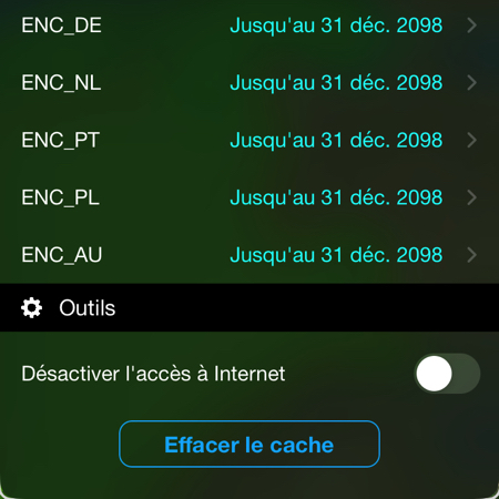
 As part of the gradual conversion of raster charts to vector charts ENC (¹) on the platform Geogarage, Weather4D Routing & Navigation now includes the following ENC catalogs :
- Portugal (derived from the productions of the Portuguese Hydrographic Service – IH)
- Poland (derived from the productions of the Polish Hydrographic Service – HOPN)
- Australia (derived from the productions of the Australian Hydrographic Service – AHO)
These ENC catalogs are added to the previous ones already available (Spain, Croatia, Germany, Netherland). Others are under negotiation such as Greece and Sweden.
–––
(¹) Geogarage to introduce ENC charts for Weather4D
–––
A quick question : when a route is calculated automatically with a given draft, is the calculation done well using the finest data? (visible at highest zoom)?
In Weather4D the routing does not take into account the water height (tide) nor the draft (boat). Routing is an optimization of a direct route taking into account weather conditions (wind) and oceanic (currents, wave height) applied to a given speed polar of your boat. The data used are those you choose when creating the weather zone covering the planned route, either the GRIB models at the highest resolution available.
Do not confuse routing with the “Auto-routing” function used by applications such as Navionics Boating and TZ-iBoat which takes you from one pontoon to another pontoon by bypassing the markers and integrating your draft and a tide calculation (sometimes fanciful). It is perfectly suited to motorboating (following the example of Waze) but absolutely not under sail.
With routing, it is up to the sailor to check that the optimized route does not pass over shoals or on the wrong side of the markers. However, in Weather4D we can apply a minimum safety distance to the coast.
Vector maps are still rasterized, with sometimes less detail than a SHOM raster map where almost all ports are described on a large scale. I just experienced this with the ENC cards of Spain : some Marinas are not described at the right scale….(Cabo De Cruz for example in the Arousa River).
We may also find reading the probes very difficult at the moment. (the font used is very very small….). And more than ever, pay attention to the zoom effect : no details then, by zooming in on the area, rock points or other. It is known, but it is good to remember, especially when building a road on Weather4D with this type of map.
Weather4D remains my faithful teammate in any case !