 Announced for three months, The first version of TimeZero has been available for iPad for a few days. Under the brand Nobeltec, bought by Signet S.A., MaxSea holding company (¹), this free application contains a simplified design suitable for the tablet technology that has made the reputation of the French publisher.
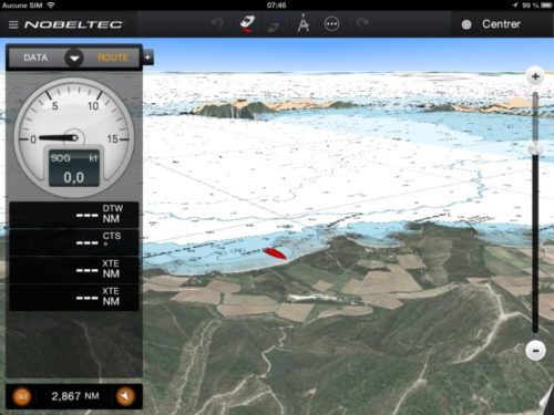
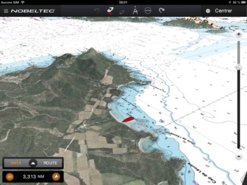
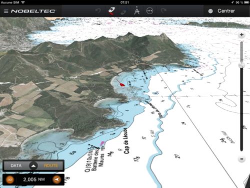
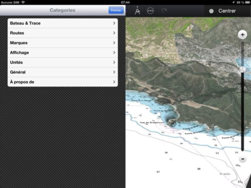
I was waiting with curiosity for a while the position taken by MaxSea about the iPad phenomenon. The least I can say is that I am not disappointed. The publisher lined up on the competition by offering a free application and providing its MapMedia charting at average price of 45 euros by geographical area, with a fairly coherent division covering Western Europe to date, the Mediterranean, North America, Central America and the Caribbean. The undeniable advantage is the overlay with 3D satellite images of the coast by PhotoFusion technology, giving to boater the sight of the boat moving in an super-realistic landscape. In addition, chart rotations speed and failover perspective by dragging fingers is actually bluffing. We have to face the facts, by aesthetic TimeZero gives quite a blow to the competition.
Aesthetics and simplicity
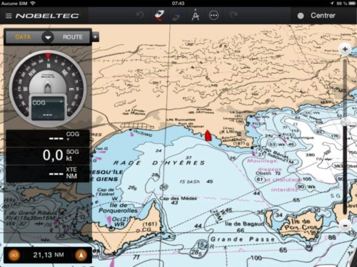
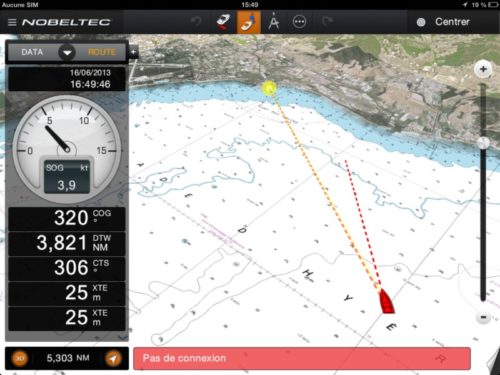
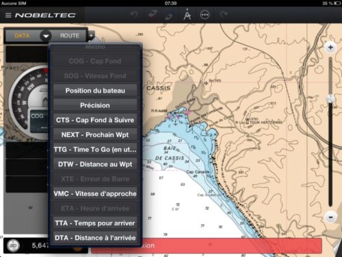
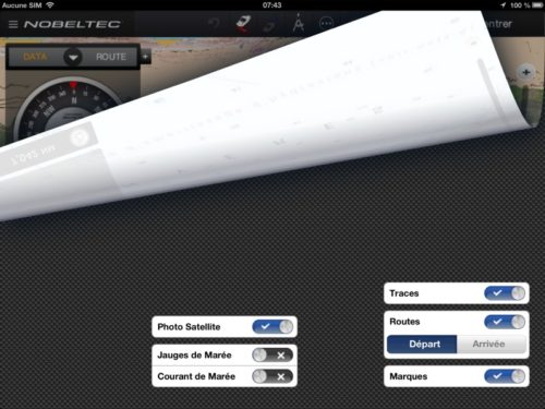
The user interface is both sober and neat. The instruments side banner, Easily retractable, is fully customizable. The general settings of the application and a limited number of functions are accessible in the upper banner, Overlay management is done by rolling up the screen by tapping on the bottom right corner, and a tap on the screen or an object opens the context menu of available functions. Efficiency and management of screen surface perfectly optimized. The app is particularly fast to handle.
Navigation functions reduced to the essentials
For this first version, MaxSea has limited the navigation functions to the essentials : Creating waypoints, routes and tracks, display information from the GPS iPad related trip to a waypoint or a route. No external interface, No data transfer, The app is completely autonomous. However, it does offer basic information : simplified weather in instruments banner, tides and currents overlaid on the chart. The users of the application with chartplotter or PC will not be confused.
Charts management in-app
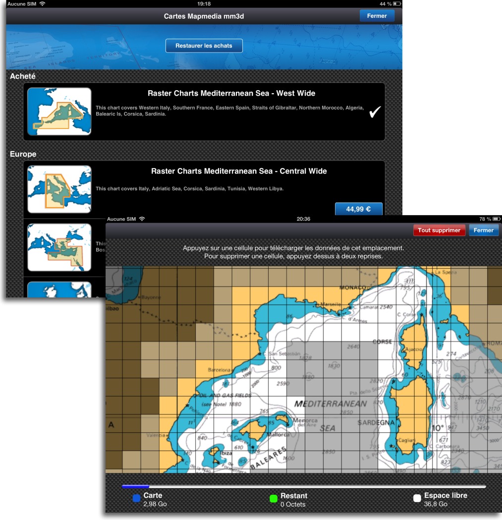
Like many of the competing apps (but iNavX) TimeZero offers charting purchase and download in-app, directly from the application.
But be careful, once purchased the chart region, The download is done cell by cell. This is raster mapping added to the associated satellite image database. As you can see in the image above, detail cells downloaded (in plain text on the screen) already represent 3 GB of file, while Navionics vector cartography hardly takes less than 200 MB. That's the price you have to pay to benefit from these superb digitized images. So plan for an iPad with at least 32 GB if you want to navigate from the Mediterranean to the Caribbean through Brittany, and a good ADSL connection for charging. Then everything will be on your iPad (except of course external data : weather, tides and currents).
Planned changes
MaxSea is already planning future developments of its application. A future major release will likely see connection to external instruments over WiFi, File transfers (waypoints, routes and tracks files) with other applications, perhaps openness to other charting editors. We should see presented at the next Paris Boat Show. Thereafter, a parallel version is envisaged as a companion to the instruments supporting TimeZero, such as Furuno NavNet 3D and TZ Touch multifunction displays. What is certain is that the app will not remain in its first stage.
My opinion
Sincere hats off to developers of this application : ergonomics, fluidity, Simplicity and efficiency. Makes excellent use of the graphics capabilities of the iPad, close to the work done for Weather4D. Bravo !
However I have long promoted the vector charting for use on tablet and smartphone. I find raster charting inappropriate to these new devices : Too much storage space, obligation to superimpose layers while zoom for details, charts transitions inconvenient, As say I do not like it. For this reason I prefer the Navionics charting, C-Map charts (Jeppesen), Sex, and BlueChart versus Imray or MapMedia. The vector technology of ENC cards (²) is really designed for computing. We lose in aesthetics but we gain in efficiency.
Despite this opinion is only mine, there's no denying that TimeZero is now the "sexiest" navigation app available on the iPad.
–––
(¹) See this article on Mapping stakeholders.
(²) See definitions in the Glossary.
–––

Tides in Nobeltec TimeZero :
Big problem with the gauges , when the tide is about an hour from low or high all the gauges in a fairly large area indicate ETALE , for example for Brest it extends from Concarneau to Abers! When in reality there is still almost 1/12 tidal.
Dangerous all the same.
René
Thank you for this super interesting post
Hello Francis
Totally agree with your analysis.
What disappoints me as it is! Tidal management , I would have liked a graph with sliders, and temporal management for tides and currents.
For upcoming developments import/export of waypoints and routes, and Weather Data Import.
Otherwise it's pretty.
Sincerely
René
As I said, TimeZero is only in its first version. We had to occupy the field by catching up with the competition. That said, all applications combined, none of them reaches the level of rigour for global tide calculations of AyeTides XL. Concerning currents, the forecasts of MyOcean available in Weather4D PRO are now an official reference.
Corrective : The publisher specifies that the brand " Nobeltec TimeZero is used for the U.S Store. with black logo, The " Nobeltec TimeZero will be used for the Store France with the blue logo below.

Francis
Bonjour
Currently the two apps are on the same store, So you can buy the same one twice !
This is especially true for cards.
René