All navigation software offer predictions of tides, more or less long range, that cover the coasts of the whole world. Where come these predictions from ? How are they established ? What is their reliability ? These are all questions that any conscientious yachtman is entitled to ask.
Origin of tides calculations
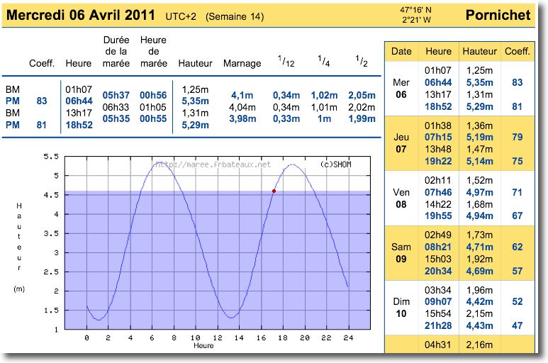
Many countries with a seafront have an organization responsible for hydrography, oceanography and sometimes maritime cartography. In France, the Service Hydrographique et Océanographique de la Marine performs these tasks. The establishment of tidal predictions represents costs assumed by taxpayers, and therefore, results are rarely made freely available to the public. In France, tidal predictions are provided with annual books (SHOM Annuaire des marées, Breton Sailor's Almanac) sold to the public or digital files sold to interested organizations (software and nautical guides editors, local administration, aso.).
This is the reason why the majority of navigation software publishers use free program predictions. XTide.
XTide is a program developed since 1998 couple David Flater, a member of Free Software Foundation (¹). It uses harmonic analysis and tide prediction calculations provided by the NOS (²) des U.S.A. as well as the harmonic files thereof. These data are provided for a large number of so-called “reference” stations and the calculation makes it possible to extrapolate the differences for other stations., called “attached”. The first interest is that XTide is free, the second is that it can cover mainly coasts around the world.
The reliability of predictions
The harmonic data provided by XTide absolutely do not take into account local particularities which may influence the tides actually observed. This is why it is provided without any guarantee and disclaiming all responsibility for the use that may be made of it..
Geographic configuration can significantly change the predictions calculated for a station, and only long-term observation, by appropriate measuring means, allows you to correct calculations to obtain the best precision. This is particularly the case for estuaries., or very closed bays. National services such as the SHOM perform locally such measures, wherever the calculations prove insufficient.
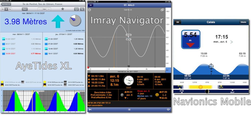
Despite this, ISVs can compare harmonic predictions with local hydrographic services publication, to correct the calculations as close as possible to the local predictions. This is particularly the case of Hahn Software which has spent a lot of time in recent months correcting its application data AyeTides and AyeTides XL.
Comparison
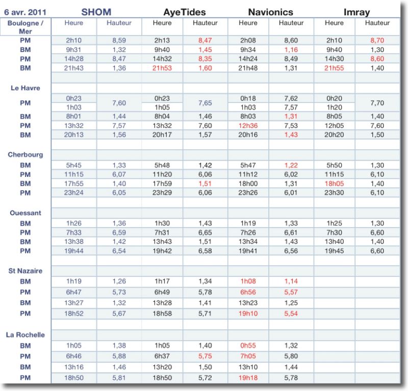
A quick comparison table allows you to measure the differences between the different predictions provided by the applications. This is just a “photograph” of a few stations over a single day., with a given tidal range (coefficient 85) and the variations may be more or less important depending on the range. However, this allows us to get an idea of the precision that can be expected from this data..
Should therefore remain cautious and to grant only trusted on these tides calculations. This said, by applying a reasonable “pilot’s foot” in all circumstances, these predictions can be considered generally satisfactory.
—
(¹) http://www.fsf.org/
(²) National Ocean Service. A department of NOAA. Data outside the U.S.A.. are provided for non-commercial use only.


Why OUISTREHAM and OUSTREHAM B. and much of the Seine ?
The differences with SHOM go beyond 60 minutes and heights gaps are greater than one meter !
The new versions have barely evolved on the Bay of Seine and two different tide indications in the same version seem surprising to me.
When in Deauville the tide curves are like a roller coaster. If there is indeed a double high tide phenomenon at Deauville it is not 5 hours after the high !
Locally it is indeed unreliable. iNavX deserves more precise software. It's a shame that we can't configure an optional link.
Ouistreham B is a duplicate of the US database which will be deleted in the next version.
With AyeTides 1.93 and AyeTides XL 1.1 (latest versions available) I obtain within a few centimeters the same heights as the SHOM for Ouistreham. There's a delay of 1 hour for HW because the lack is 1 hour steps (from 12:32 a.m. to 1:32 a.m. and from 12:56 p.m. to 1:59 p.m. today for example).
For Deauville, it is actually completely wrong. I will tell August Hahn about it.
There is no more precise software, SHOM would have to agree to sell its files to developers, at a reasonable price. And it’s not just France. If developers had to buy files from all countries, they should sell their software at prices that no one would want to pay for it. Hence the use of XTide, free but perfectible.
It is unfortunately true that the tides in the Channel are particularly twisted, also on the English coast.
Interesting, but what would the same study give, for random, the Gulf of Morbihan ?
I'll look when I have a moment, but not for a few days.
In the Gulf of Morbihan, we can actually have significant differences between the SHOM data (found on frbateaux.net) and those of the Navionics iPhone app. For example for today 8 th :
SHOM
LW = 04:00 – HW = 09:53
H = 0,30m H = 2,65m
Navionics charts
LW = 04:28 – HW = 10:26
H= 0,60m H = 2,82m
Sorry, I forgot to mention that it was the port of Logeo
Very interesting information and small comparative study … merci !