[Updated 29 July 2022]
For several years, forecast files in GRIB format have been widely used in meteorological applications.. The majority of forecast models have been made freely available by meteorological services, all countries included. Apps like XyGrib, LuckGrib, SailGrib, Weather4D and others, offer a selection of atmospheric and oceanic models, up to 60 Weather Models, Waves and currents for Weather4D, more than thirty models with LuckGrib, in example. But there are always others that can usefully complement the standard offerings of these applications.
Just for Western Europe, several dozen high-resolution models are available for download, freely accessible, and in a format compatible with the majority of applications. Today there are two formats used by weather services : GRIB1 and GRIB2 (¹). The latter, enriched, is still only compatible with professional readers, and a limited number of recreational applications. It is sometimes necessary that the GRIB2 format be converted to GRIB1 in order to be recognized by applications (²).
Although Europe is already well covered by the most popular high-resolution models, like ARPEGE and AROME from Météo-France, ICON-EU by the German Weather Service (DWD), here are some examples of commonly used and easily accessible models (³).
EUROPE DU NORTH
-
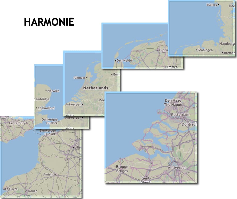
HARMONY
(HIRLAM ALADIN Research on Mesoscale Operational NWP in Euromed), is produced by the Royal Netherlands Meteorological Institute (KNMI). This model is part of the European HIRLAM program (High Resolution Limited Area Model), managed by several European meteorological institutes. The HARMONIE model covers Europe with a resolution of 0.045° (5 km), up to 48 hours steps, updated twice a day (00,12UTC).
The HARMONIE-AROME Cy40 model covers localized areas with deadlines of 48 high resolution hours of 0.025° (2,5km) in one hour steps, updated 4 times a day (00, 06, 12, 18UTC) available approximately 5 hours later in GRIB format. The KNMI makes the GRIB files of the Harmonie model available free of charge on its data platform in GRIB2 format. GRIB2 files are converted to GRIB1 format and uploaded to the website Euros Sailing of the sailing club of the University of Twente (The Netherlands).
In total 8 areas are covered from Dover Strait to eastern Denmark. The data provided is : wind at 10m, gusts, atmospheric pressure at sea level, temperature at 2m, relative humidity, precipitation.
-
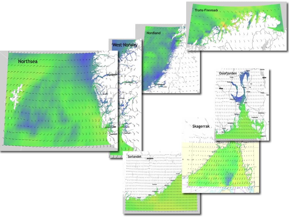
Yr – NMI
The’Norwegian Meteorological Institute (Meteorological Institute) offers on its dissemination website Yr.no a list of GRIB files covering the Norwegian coast in GRIB1 format : wind, currents and waves. Wind files have a variable resolution depending on the area, with 1 updated four times a day (03, 09, 15, 21 UTC). Waves have a variable resolution depending on the area, with 1 hour updated twice a day (06, 18 UTC), the currents have a variable resolution depending on the area 1 hour updated once a day (00 UTC) . All forecasts have a range up to 66 hours steps.
The GRIBs are unfortunately quite poor. The wind files provide only the average wind data at 10m, waves the significant height, currents speed and direction.
EUROPE SUD – MEDITERRANEAN
-
OpenWRF
OpenSkiron (⁴) propose 10 areas covering Western Europe and the Mediterranean. Each zone is associated with a 0.01° WRF model (± 12 km) with 3 -hour steps range up to 5 days, updated 2 times a day (00, 12UTC) available around 5 hours and a half later.
Each of these areas contains one or more high-resolution 0.036° WRF models (4 km) with 1 -hour steps range up to 24 hours steps, updated 1 time a day and available at variable times specified on the dedicated page. No less than 32 areas are proposed with this resolution.
Data provided are GRIB1 format : wind at 10m, gusts, atmospheric pressure at sea level, temperature at 2m, cloud coverage, relative humidity, precipitation, snow depth, air temperature, CAPE. Added to this are swell and wave forecasts due to wind. (height, period and direction), and current forecasts (speed and direction).
OpenWRF Gribs are produced using the EMS-WRF model, sourced from NOAA, with the last kernel of the non-hydrostatic mesoscale model ARW. The advantage of these forecasts is that they are produced by a high resolution non-hydrostatic regional model which models local weather phenomena well, while global models such as the GFS are hydrostatic models which, by definition, better model the synoptic time scale than regional and local weather phenomena. Wave data are from the model WAM (WAve Model) coupled with ECMWF atmospheric model and currents from Mercator Ocean.
In conclusion, these complementary models can make it possible to refine forecasts in certain areas where high-resolution models may be lacking. This short presentation is of course not exhaustive., and there are many other models specific to various regions of the globe.
–––
(¹) See Glossary
(²) Files with .grb extensions / .grb.bz / are generally compatible.
(³) It should be remembered that the leading European model IFS from February the ECMWF (ECMWF) is still only very partially available for free (see Related Articles below).
(⁴) OpenSkiron is an Israel-based website administered voluntarily and generously by David Gal.
–––
Related articles :
ECMWF weather data soon open to public [1st part]
ECMWF weather data soon open to public [2rd part]
–––


Being able to read and use (not just load) Do OpenSkiron files in Weather4D Routing and Navigation require you to have subscribed/renewed the weather subscription? ? Merci
No, no way !