 A year after my advocacy for free European data (¹) Météo-France finally offers free access to its two famous ARPEGE and AROME models. A welcome development, started in 2014 by the success of MyOcean, since then integrated into Mercator Ocean (²), but a notable change of attitude for a public establishment which has always been asked to self-finance a significant part of its budget. Forecasts from these two models are made available on Météo-France portal in the GRIB version 2 format. Since the 21 July 2015.
Reminder of Open Data context
In a press release dated 31 October 2012 and titled Opendata (³), the Government had confirmed the continuation of the steps of public open data. These steps following the Digital Agenda (⁴) published by the European Commission, which stated that "Open data refers to the idea that some data should be freely available for use and reuse " and citing as an example : " … igeographic information, statistics, weather data, data from state-funded research projects, and digitized books from libraries ”.
Quoted by the InfoClimat forum (⁵), the Direction of Météo-France :
" … explained that the opening (free and open availability on the internet) of our model outputs constitutes an opportunity to defend our positions, and not a threat, even if in the short term, this can cause a small drop in revenue..
This notion of "small drop in revenue", that should worry the public institution staff, request analysis. Looking closely, in the program 170 “Meteorology” of the Senate (⁶), analysis of Météo-France budget reveals an overall drop in commercial revenue :
" … the fees collected for the provision of public data are approximately 2 million euros per year, knowing that most raw data produced by Météo-France must be made available free of charge. ”
However, it must be seen that these commercial revenues (35 M€ in 2014) represent less than 10% of the total annual budget of Météo-France (± 400 M€). The share of royalties collected for public data turns out to be minimal (less than 6% commercial revenue). The generalization of this free service will therefore not weigh heavily on the establishment's accounts., even during periods of spending control imposed by strong budgetary constraints. In return, Météo-France will not only enhance its reputation by widely distributing its quality products to a quantity of actors affecting the general public : weather websites, specialist weather app developers, service providers, aso., just like NOAA for over 20 years old.
GRIB files diffusion
The GRIB files are made available on two web pages of Météo-France public data :
- Model ARPEGE : 0.5° resolution (30NM) for the world, 0,1° (6 NM) for Europe, range up to 96 h. Available every 6 hours steps.
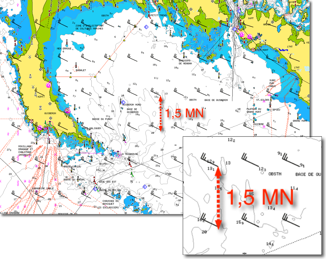
- AROME model for mainland France : resolution of 0.025° (1,5 NM), range up to 36 hours by 1 hour steps. Available every 3 hours steps.
Warning, these files are in GRIB V.2 format, a format that is not yet managed by many applications, not even Navimail2 ! Developers will need to quickly adapt their products to make them compatible. They will also be faced with another problem. Files are free for manual downloading.. To automate the procedure for downloading data from applications, you must subscribe to a Premium service :
Un service « Premium », subject to annual pricing (15 K€), to obtain the Arpege and Arome daily automatically data set, with stabilized diffusion conditions (better bandwith capacity). This service can also benefit from a better resolution for the data from the model Arome, but at the expense of the number of parameters available.
Suffice to say that only "sizes" among developers will be able to afford such a service, and will inevitably have to charge back to users by the mean of subscription, as typically US GRIB files at high resolution WRF. With a modest subscription of 15 €/year, in example, a developer will only recoup his costs if he knows he can count on 1000 annual subscribers. May the best win !
Météo-France data in applications
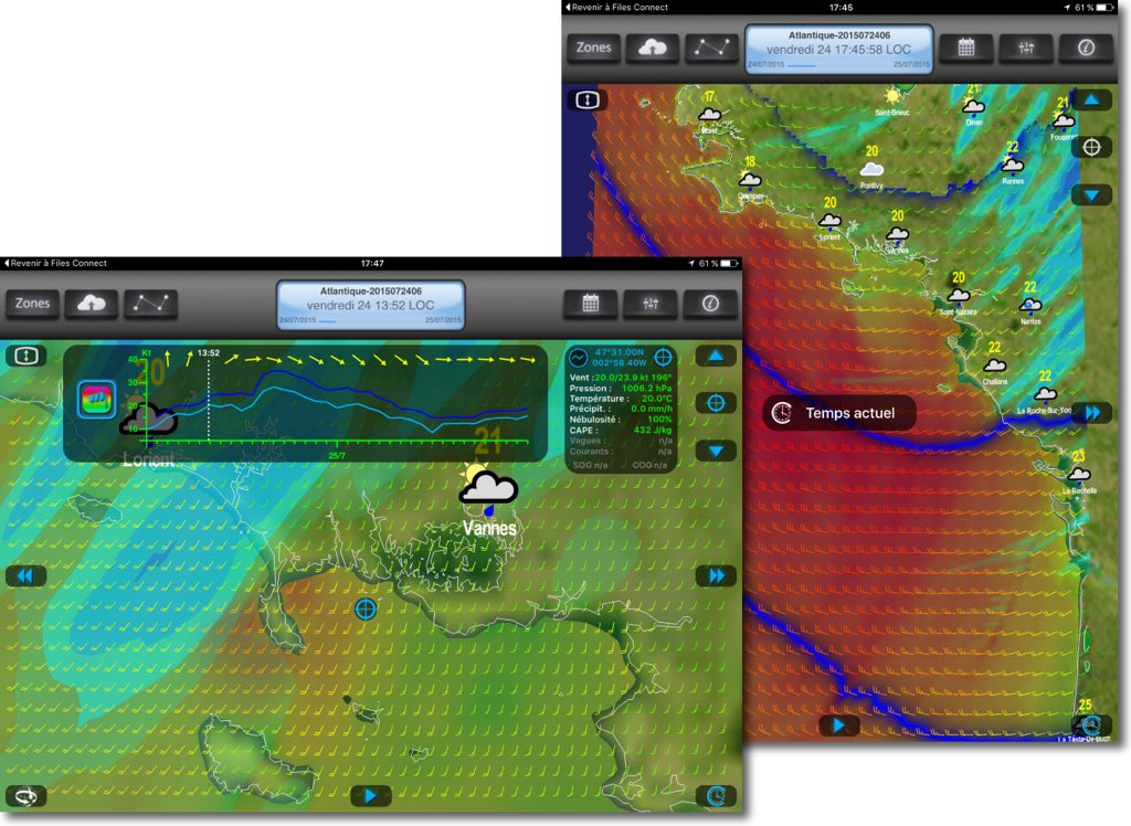
Olivier Bouyssou, French Weather4D developer that I no longer introduce, has reprocessed the GRIB V.2 file to allow me some display examples.
Realizes here fineness of the grid. The sailors will be able to carry out precise routing on the coastal courses, knowing that we can combine current forecasts at the same resolution (MyOcean IBI 1/36° in Weather4D).
Quality of weather data
The ARPEGE model for the world, despite its range limited to 4 days, has nothing to envy to equivalent resolution NOAA GFS model . Its variation at a horizontal resolution of 0.1° for Europe is considered better than its competitor WRF. The AROME model is the finest available for the coasts of France and neighbouring countries. This sophisticated model can integrate relief effects and thermal breeze effects. These two models are constantly improved :
In a recent post entitled "Météo-France improves numerical weather prediction systems., the establishment announces :
"Digital models AROME and ARPEGE, which simulate the evolution of the atmosphere, have also evolved. Their spatial resolution has been improved. The regional model AROME […] thus saw its horizontal resolution increase from 2,5 km to 1,3 km. The relief is now depicted more realistically in AROME.
The representation of physical phenomena in models has also progressed. The new version of ARPEGE, that is global, for example benefits from a better modelling of clouds type cumulonimbus and precipitation associated..
So we have everything to gain to use these models to our own coasts, but also to compare them with American models, and thus finally benefit from a high quality alternative in the decisions we will have to make at sea. Bravo to this opening, and I can't wait for these models to be operational in our favorite applications.
—
(¹) Plea for free European data
(²) After having successfully coordinated European MyOcean projects since 2009, Mercator Ocean was officially appointed by the European Commission on 11 November 2014 to implement and operate the "Copernicus marine environment monitoring service" under the European Earth observation programme Copernicus.
(³) Press release from the Prime Minister of 31 October 2012
(⁴) Digital Agenda for Europe
(⁵) http://forums.infoclimat.fr/topic/85261
(⁶) Finance bill for 2015 – presentation notes
—


Bonjour
How do I use the pro app to view the files??
Thank you again for your work…
Hubert Dereux
Bonjour
For several months I have been a very satisfied user of Weather4D PRO which I use daily during my Breton holidays.. I would like to know if there is something specific to configure or an update to be made to integrate these Météo-France GRIB files into Weather4D PRO as simply as is possible with email requests for US Grib files. ?
You will have to wait for an update of the application. Ask the developer.