 In recent years, websites allowing the visualization of maritime traffic have developed on the web.. They continuously transmit via the internet the positions received from the ships' AIS transmitters, received by reception bases on land, all along the coasts. Two of them caught my attention because they present very different options : Marine Traffic et SiiTech.
Marine Traffic, the community AIS
Marine Traffic was, originally, a university project, free and community-based project, dedicated to the collection and presentation of data used in several areas of research. Now a business, Marine Traffic continues to provide free, near-real-time information to the general public, and paid services to professionals, regarding ship movements and ports, with global coverage. Initial data collection is AIS-based through the largest network of land-based reception bases, supplemented by offshore satellite data. Marine Traffic offices are located in Greece, in the United Kingdom and Singapore.
How is the data collected ?
Based stations are equipped with an AIS receiver, a PC and a high-speed internet connection. These stations may have a range of 40-60 MN depending mainly on the elevation of their antenna. The AIS receiver receives the data which is processed by software on the PC, encoded in NMEA format, then sent to a central database using a “web service”. This software is free for anyone interested. Marine Traffic project is constantly looking for people wishing to take part in community. They will need to install an AIS receiver and share data from their area with Marine Traffic, in order to cover as many areas and ports around the world as possible.
Data display
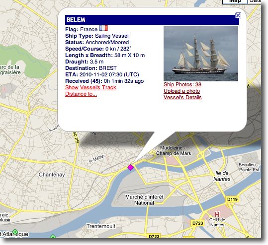
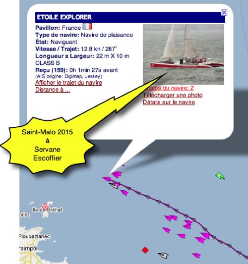
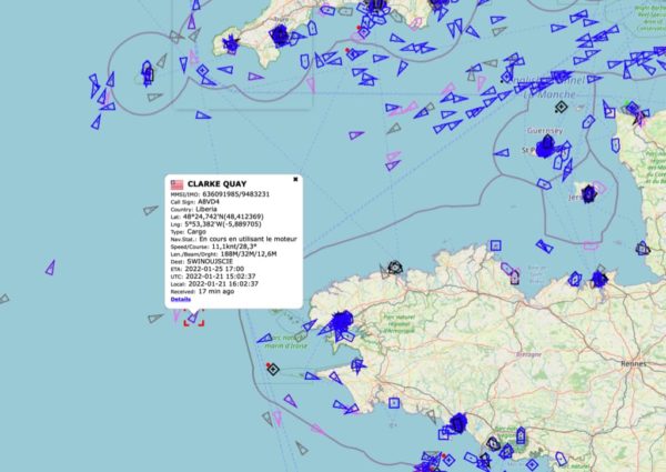
Vessel position and track are displayed on an OSM Live Map as data is received. Positions are shown in near real time but may be up to an hour behind reality.. Information regarding vessel characteristics is provided, as well as their photos when available. Different icons characterize ship types, and if they are underway, stationary or dockside. Data is updated automatically, or manually by refreshing the browser page. Out of range of terrestrial reception stations, vessel tracking is done by satellite and requires a paid subscription to the service.
For what use ?
Marine Traffic will be primarily an information database, to follow the route of known vessels, or view the areas of highest traffic, in example. Not as a means of security.
SiiTech AIS Server, professional services
SiiTech is a company founded in 2004 in Vancouver, Canada. SiiTech server works on the same principle of collecting information from AIS shore-based receivers, but its destination is totally different. SiiTech provides a set of payed web services for different professional needs (Vessel Traffic System), and different levels of access to an AIS server to receive AIS and ARPA data (*). A simplified web interface is made available to users free of charge.
AIS Server is the base for SiiTech maritime traffic display solution. Combined with Web VTS, AIS Server allows the analysis, filtering and representation of information for users from one or more AIS base stations, from AIS transponders and/or receivers. From 2015 SiiTech received ISO certification 9001 quality management.
With iNavX
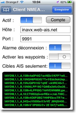 Access to the SiiTech server has been implemented in iNavX from version 3.1.7. Free at first, this service now requires a fairly expensive annual subscription. Usable only in coastal navigation, a permanent Wi-Fi or cellular connection is essential. The server is to select in TCP/IP view. Once connected, iNavX receives NMEA AIS targets information present within 30 MN of the ship's position. Targets are displayed on the map in iNavX, and information about them is available with a simple tap.
Global coverage has increased significantly in recent years, but without reaching the density of Marine Traffic. There is much more data on the main traffic routes, like the Channel and the North Sea because the stations on the British coasts are numerous. A look at the world map on their website allows you to realize this.
These Web services are interesting and will certainly grow in the future, by increasing the capacity of Internet connection and the spread of AIS transponders on ships, including leisure yachts. But be careful, these services should in no case be used for security, but only for information on traffic density or tracking a friendly boat. They cannot replace the presence of an AIS receiver on board, or even better a transponder, for browsers who consider them essential for their security. These devices are the only able to provide instant information, independent of any internet connection.
Other servers
Other AIS tracking services have developed, as Vessel Finder, Marine Traffic's biggest competitor, AISHub which always offers a Free APIs allowing the integration of the service into an application, as in Weather4D Routing & Navigation et SaiGrib WR, or even Spanish LocateEverything. And I certainly forget some…
—
(*) See Glossary
—

