in May 1992, the International Hydrographic Organization (IHO) had adopted a standard aimed at defining the specifications of electronic charts, the ENC, used by ships, as well as the devices that display them, Called ECDIS. This standard has been published under the name S-57 – IHO Special Publication N°57. This standard was subsequently significantly updated, The version 3.1, in November 2000. Ten years were then left to the various operators, manufacturers and publishers, to bring their navigation systems on board ships into compliance. In January 2010, A new standard S-100 IHO Special Publication – Universal Hydrographic Data Model has been published, an important evolution aimed at adapting to this rapid growth in the data available for navigation.
The S-100 standard
Indeed, as e-navigation becomes more widespread, Mariners have access to maritime data feeds from multiple sources that allow them to navigate with ever greater safety and efficiency. However, with the increase in the amount of information and the number of sources, It is becoming essential to standardize the data so that it can be easily integrated and displayed appropriately on navigation systems. After several years of evolution, The’IHO published in December 2018 version 4.0.0 of the S-100 standard (¹). In 2019, Multiple Specifications (²) of the S-100 standard have been updated and published.
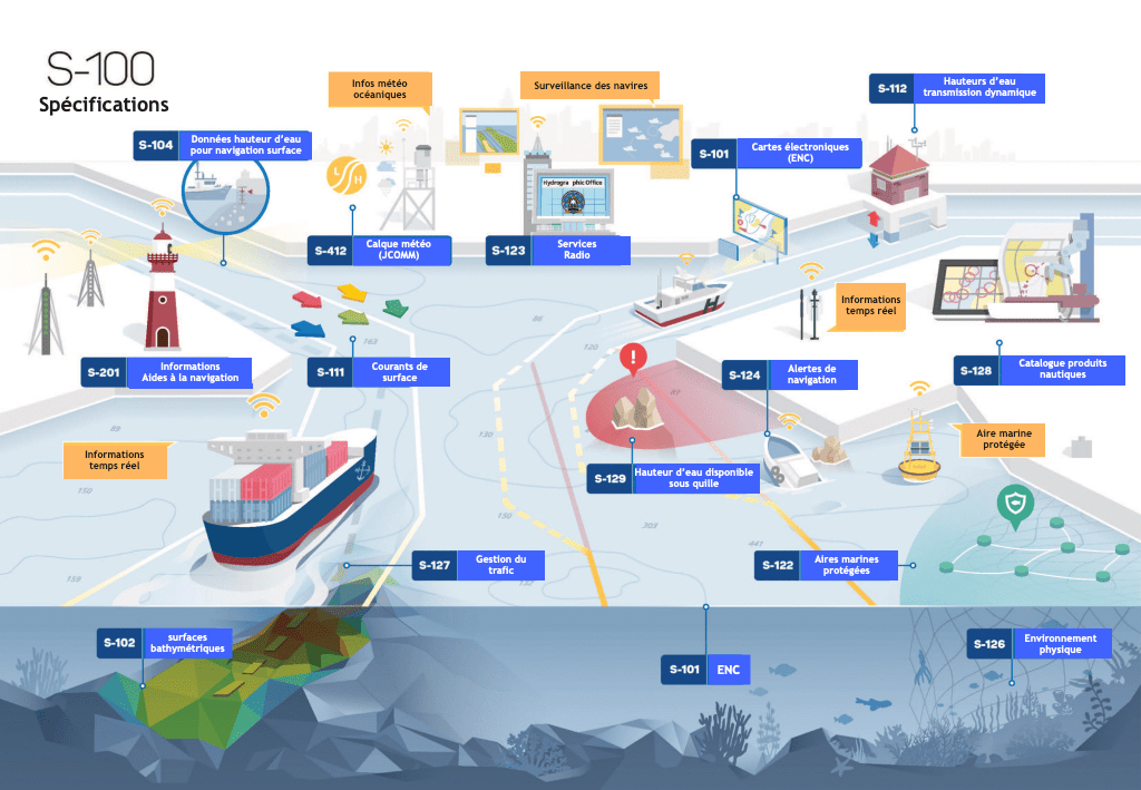
The S-100 standard is the IHO's framework for the standardization of maritime data products such as high-resolution bathymetry, surface currents, marine protected areas and new standards for electronic navigation ENC charts. Basically, The S-100 framework of standards uses ECDIS readable catalogues that will lead to plug and play and will allow for easier updating of data standards. The development of the S-100 infrastructure is governed by the IHO S-100 Working Group and is currently chaired by the NOAA.
NOAA's contribution
NOAA departments are actively involved in the development of the S-100 standard and related product specifications and are working to align new products and services with the S-100 series of standards under development. This will allow sailors to have more information integrated into their navigation systems, which will help them plan optimal routes and make crucial decisions at sea. For example, The administration is working to make the next edition operational 1.0.0 to S-111-Surface Currents extracting data from NOAA's operational prediction systems and converting them into a format that can be imported and displayed by navigation systems. In addition, the National Weather Service's Ocean Prediction Center (NWS) works through the World Meteorological Organization (WMO) to produce S-412 ocean forecasts, who also use the S-100 frame. Other products, including S-102 – High-resolution bathymetry, S-112 – Water level predictions, and S-129 Under Keel Clearance management systems (UKC), are also in various states of development that will facilitate precision navigation in commercial harbours around the world.
Current developments
Between January and October 2019, IHO has published the specifications (³) products for the S-102 Edition 2.0.0 – High-resolution bathymetry, and the list of the following specifications incorporated into the version 4.0.0 :
- S-101 – Electronic navigational charts
- S-111 – Surface currents
- S-122 – Marine protected areas
- S-123 – Radio Services
SHOM's orientations
[July update 2021] In its Contract of objectives 2021-2024 (⁴) Published in July 2021, SHOM specifies :
The IHO roadmap provides for the provision of ENCs in the S-101 format from 1 January 2024.[…] As of fin 2023, the S-57 format will no longer be used within SHOM, and only the S-101 format will be used for the production of electronic boards.
And he adds :
The inevitable extinction of the paper card produced as a specific document results in the refocusing of SHOM's activity on the electronic board and the products of the S-100 family. In this context, The generalisation of print-on-demand contracts will be promoted by making it available to resellers who wish to do so, Digital map data in raster format. Moreover, SHOM digital reference data will continue to be provided in their usual formats (vector or raster depending on the client), to companies in the nautical industry that are already integrating them into their own digital offers for boaters.
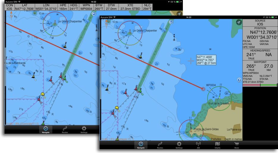
Even if this subject does not immediately concern pleasure boating, It is worth taking an interest in it. Several manufacturers of navigation instruments are as much in the professional marine market as in the pleasure craft market, and with the generalization of vector charts, there is no doubt that our instruments and applications will eventually have to meet these standards. ENC charts under S-57 standard, although not very common in yachting, have been used by several compatible applications on our computers and mobile devices for several years now.
–––
(¹) S-100 Project
(²) (³) http://s100.iho.int/S-100-specification
(⁴) Objectives and Performance Contract 2021-2024
–––


