Since version 3.6.1 iNavX provides overlay of GRIB weather files in high resolution from theyr.com. This English website owned by Kona Ltd company is the developer of the application GribView which I talked about in a previous post (¹). An active account on x-traverse.com must be open, and done subscription to one of the Theyr subscriptions.
Actually x-traverse.com website allows two subscriptions :
- Theyr Standard – Mobile at the annual price of $9,99 (environ 7,85 €) or monthly of $3,99 (environ 3,10 €)
- Theyr Premium – Mobile at the annual price of $19,99 (environ 15,70 €) or monthly of $6,99 (environ 5,40 €)
These subscriptions allow permanent and unlimited visualization of forecasts, overlayed on the displayed chart.
- The Standard subscription includes data : Vent, Pression, Precipitation rate, Air temperatures from GFS model (²) with a grid of 0.5° and 1° global for the world.
- Premium subscription includes, in addition, the data : Vent, Pression, Precipitation rate, Air temperatures, Sea Surface Temperature from high resolution WRF-NMM model (²) with fine grid of 0.1° (6NM) can be reduced to 1 nautical mile in certain areas, Wave height from WWW3 model .
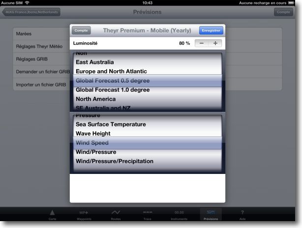
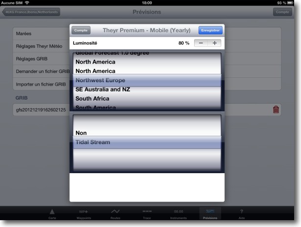
A new “Theyr Weather Settings” option in the view Forecast view allows choose area and data display, and the brightness of forecasts overlay :
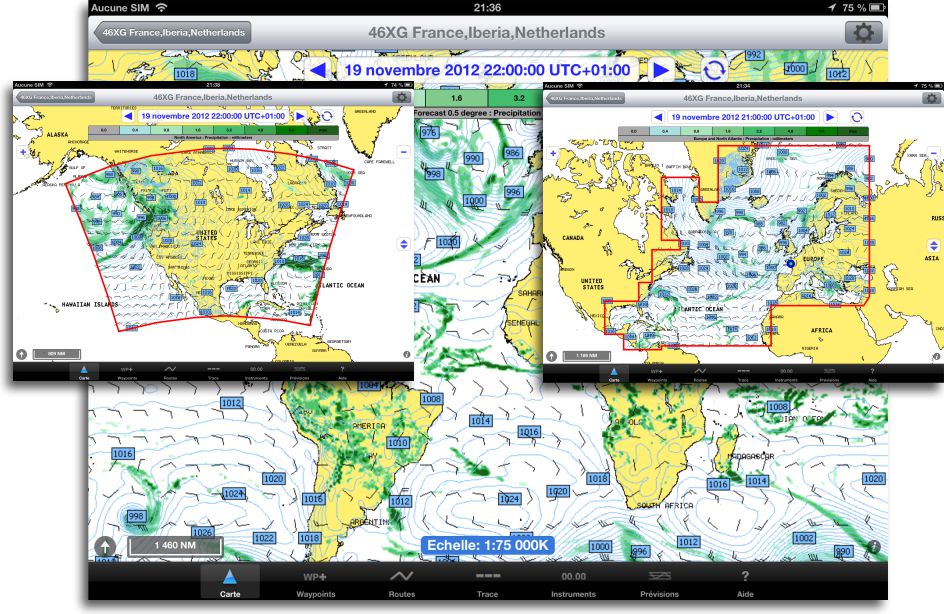
Back in Chart view, loading takes place automatically. You can scroll through forecasts manually by ◀ and ▶ buttons or automatically by an animation button.
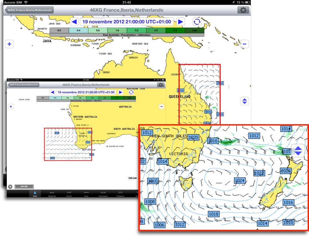
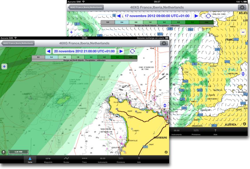
Only GFS forecasts cover the world, NMM forecasts high resolution concern specific geographic areas, as above for Europe and North America and below for Australia :
Some areas, as Gibraltar or the Channel have grid reduced to a minimum of 1 nautical mile :
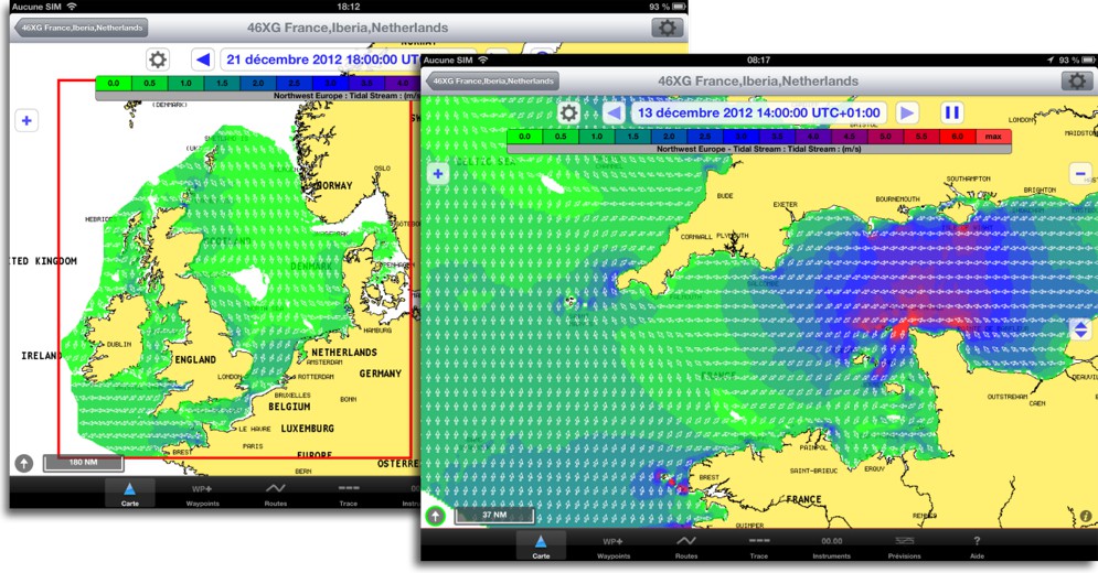
Current prediction for the British Isles and the Channel is also available :
Prediction display on chart, with adjustable brightness, is significantly better than Saildocs GRIB files, especially for precipitation.
Although very cheap, annual subscription is mandatory and is only activated for a single device (iPad or iPhone). On the other hand, this service will be interesting only to prepare navigation onshore. Forecasts will not be accessible at sea.
Must imperatively be connected to the internet with excellent speed, preferably WiFi because 3G speeds in France are too much limited. Indeed, the amount of data downloaded in real time is about 10 times higher than GRIB data. We are penalized in Europe by a significant delay in the implementation of broadband, while in the U.S. the spread of WiFi and 4G LTE high-speed networks along the coast may justify the interest of such a service.
—
(¹) GribView 2.0, Finally a free GRIB viewer for Mac OS X
(²) See “Forecast Models” in the Glossary.
—

Thank you for your response which sheds some light on my “lantern”.
Well done Mr. Fustier,
As per usual, you provide a clear and reasoned answer to the question of the benefit of subscribing to this new service. I still wonder about the accuracy of forecasts in the Mediterranean , what do you think? GFS Gribs are often pessimistic and wind near the coast often poorly known (topography effect). Please give a review. Sincerely. D. Vergniol.
The GFS model is not so bad for the Mediterranean. But it is established that takes little account of topography effects near the coast that have an important influence on local weather conditions. The European IFS model, or better yet Arpege from Météo France, provide greater precision of prediction. Unfortunately they are chargeable, accessible only with Navimail. Option of fine grid GRIB files from Great Circle, available by subscription from the application Weather4D PRO, provides greater precision for the Western Mediterranean. I could make many comparisons last summer from Port Leucate to Croatia which have demonstrated the quality of such predictions.