![]() Weather4D Routing & Navigation offers a choice of raster charts from many international hydrographic services . Charts folders are available for application on the French web server Geogarage. Charts are subject to an annual subscription by Publisher directly on Geogarage website after creating an account there. After subscribing to a publisher, the entry in Weather4D 2.0 credentials created in Geogarage activate display of subscribed folder , ready to download. Procedure step-by-step :
Weather4D Routing & Navigation offers a choice of raster charts from many international hydrographic services . Charts folders are available for application on the French web server Geogarage. Charts are subject to an annual subscription by Publisher directly on Geogarage website after creating an account there. After subscribing to a publisher, the entry in Weather4D 2.0 credentials created in Geogarage activate display of subscribed folder , ready to download. Procedure step-by-step :
Category : iOS – iPadOS
Weather4D 2.0 revisits navigation on iPad [Update]
 Weather4D 2.0 is available sur Apple AppStore (*). After the success of the first two versions, APP4NAV company just revisit chart navigation on iPad and iPhone by integrating the timing dimension. With simulations and weather routing, navigation becomes predictive, allowing a constant anticipation of future weather conditions and sea state. This “navigation into the future”, relied on the quality of meteorological and oceanographic predictions today available, was designed in order to bring a new dimension to the safety of boaters. Read more …
iNavX undergoes a change of ownership
 New developers, new logo, new splash page, and new website.
The version 4.7.0 has just been delivered by NavX Studios LLC, the company that bought all of Richard Ray's computer creations : GPSNavX, MacENC and iNavX.
The handover took place during the summer. New developers (there are two of them) were first focused on iNavX, for a first debugging update, performance optimization and acceleration of charts downloading with X-Traverse. We can bet that this transfer will bring a new dynamic to these excellent applications, whose creation and development have rested since 2002 on the unique Rich Ray's keyboard.
I continue to test and produce the French version of these applications on behalf of the new team.
Use your iPhone as a GPS for iPad Wi-Fi
 With the appGPS2IP, we can use (temporaly) the GPS of an iPhone to transmit the position to a Wi-Fi iPad that does not have GPS.
But this method should only be seen as a temporary repair for the reasons which will be mentioned later.. NMEA position data will be sent by GPS2IP using TCP/IP protocol through cellular tethering.
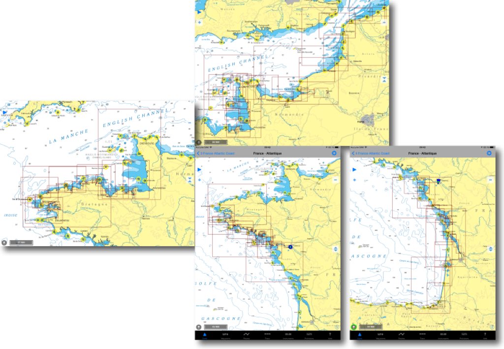
NV Chart extends coasts of France from SHOM
In a previous entry I presented the SHOM raster charts provided by many publishers on iPad. For several weeks the German nautical chart publisher NV Verlag offers two new areas ending coverage of the coasts of France Atlantic and English Channel. These charts are usable both with iNavX on iPad/iPhone, only with GPSNavX and MacENC on Mac. We can therefore, unlike Navionics, use the two available copies of each region on two different media (iPad , iPhone ou Mac).
The new TimeZero arrived
You remember the launch of TimeZero in June 2013 and the interest aroused among the many users of MaxSea on PC. I then wrote :
MaxSea is already planning future developments of its application. A future major release will likely see connection to external instruments over WiFi, File transfers (waypoints, routes and tracks files) with other applications, perhaps openness to other charting editors
We waited, hoped, and then Pschiiitt ! No more evolution since that date except for a few cosmetic improvements in November 2013 before the Paris Boat Show. No more contact for me with the developers (I was a tester for the beta versions). No more news for a year until rumors reported from the last METS in Amsterdam reporting an ongoing development integrating (finally) AIS, and also WiFi radar DRS4W by Furuno. This has now been done since the 23 th. Read more …
iNavX and iSailor always offer more functions
The year 2015 barely started, the developers are already giving us the developments of their applications, probably made between two glasses of champagne during the holidays. I consider iNavX and iSailor as the two best navigation apps so far under iOS. These are the ones that offer the most extensive functions and the selection of the best charts. They each have their qualities and faults., and I take advantage of the new features brought by their recent update to try a quick function/price comparison.
Warning, this exercise is associated with a snapshot vision, valid today but quickly obsolete tomorrow, as changes are rapid in this domain. On the other hand, it is always difficult to distinguish between objective and subjective aspects in a comparison., I was already confronted in the past (¹). Read more …
Iridium Mail & Web became fully usable again
 Since release Apple iOS 8 early October 2014 the messaging app Iridium Mail & Web app (qui a remplacé Iridium Mail & Web app) was no longer able to export an attachment to another application using the “Open in” function.… ”. De ce fait on ne pouvait plus utiliser un fichier météo GRIB reçu en pièce jointe depuis le serveur SailDocs dans aucune application, principalement Weather4D PRO.
Il aura fallu plus de 3 mois pour que deux mises à jour successives viennent corriger ce problème sévèrement handicapant pour les utilisateurs clients de Iridium :
Compass Eye et SeaNav, good surprises from Pocket Mariner
During a search on the App Store for my previous post, I found out under the term "Simrad" an application that furiously reminds me of something. From research to research, I discover the company Electric Pocket. This British applications publisher Develops the Mobile Apps from 1997, andrecently the applications Nautical under the name Pocket Mariner. That Company is based in Wales, United Kingdom, and deals with partners from all over the world.
Read more …
Marine electronics manufacturers and the tablet phenomenon
 A few days before the opening of the Nautic Paris boat show where, I remind him, I will be present on the stand iTabNav (Hall 2.1 – D31), An overview is in order. And precisely, in our immediate horizon we shall have, like every year, proximity to marine electronics manufacturers and their representatives.
At the previous edition of the boat show, I had noticed the reluctance – not to say hostility – of manufacturers towards the growing phenomenon of tablets and other smartphones on the navigation market. By dint of promoting these devices and their applications, I probably didn't just make friends in this business. However, Strong pressure from boat buyers, et donc d’électronique de navigation, a contraint lesdits fabricants à intégrer un minimum d’interactivité entre leur propre matériel et les appareils mobiles possédés désormais par une majorité de navigateurs.
Ce qui m’incite à faire un rapide point sur l’état des applications fournies et l’avancée des fonctions proposées.


