 New publication of User Guide to Weather4D Routing & Navigation in French version. Warning, it is a new version to download which replaces the previous one (¹). The old guide should be removed from your library in the Apple Books app. Read more …
Category : iOS – iPadOS
Navygatio : Weather4D's 5th dimension [Update]
Weather4D Routing & Navigation brings a major novelty : The ServiceNavygatio (¹), a web interface which will allow to record the navigations on a server as time goes by, add photos, to share own page with relatives, compare tracks, Analyze performance, and much more to come. A real " Cloud at the unique service of Weather4D Routing & Navigation users with iOS and SailGrib WR with Android. Read more …
Routing : from reality to play (episode 3)
While, this morning of the 9th day, Hugo Boss en tête du Vendée globe 2020 finishes crossing the “Doldrums” at a slow trot (¹), suivi par la flotte des concurrents qui s’étale derrière lui jusqu’au nord des îles du Cap Vert, c’est une toute autre partition que jouent les leaders du jeu Virtual Regatta. Read more …
Routing : from game to reality (continue)
Friday 13 November will not be a lucky day for the Vendée Globe skippers 2020 (¹). Ils vont devoir négocier la rencontre avec la tempête tropicale « Theta » qui croise leur parcours avec des vents moyens pouvant atteindre les 40 nœuds et de puissantes rafales. Surtout la mer sera à craindre car, fortement croisées au passage du centre dépressionnaire, les vagues pourront dépasser les 6 mètres et déferler de façon chaotique. Read more …
Routing : from game to reality
On the second day of racing of this Vendée Globe 2020, we can say that the weather conditions that the skippers will experience on the descent towards the Doldrums will be particularly tough. Après un départ par un temps de demoiselle, un premier front froid peu actif passé sans encombre, les solitaires vont traverser un deuxième front beaucoup plus violent dans la nuit et la matinée de mardi à mercredi, pour le groupe parti à l’Ouest, et dans la soirée pour le groupe passé entre le DST (¹) et la Gallice.
Mais ces conditions à venir sont bien différentes pour les joueurs de Virtual Regatta et pour les marins… Read more …
Navigation Mac embarks on the Vendée Globe 2020
Hey yes, everything happens ! In all my computer-nautical career I had never played any computer game whatsoever, not even the historical Windows card game that consumed thousands of hours of idle office time for businesses… but you should never say : Never !
So, therefore,, here I am registered for Virtual Regatta, one among the most 340.000 players registered at this time, ready to start the Vendée Globe tomorrow at 1:02 p.m.. Like any beginner, I watched a few videos to quickly understand this game, Who, on balance, seems relatively easy for a confirmed sailor. But, from there to play in the big league, there are still several oceans to cross ! Read more …
Weather4D embarks on the Vendée Globe 2020 [Break News]
No, it's not a joke ! Weather4D Embark with SailGrib in the Vendée Globe 2020 with Virtual Regatta. The two friends Henri and Olivier have together developed a routing module directly integrated into the game.
Philippe Guigné, the creator of the online game Virtual Regatta, explains in an interview with Voiles & Voiliers :
"… we want the virtual Vendée Globe to be aimed at the general public and it is therefore logical that we help neophytes by providing new tools. Thus, For this edition, we offer a routing assistance system, Directly integrated into the game, in partnership with SailGrib and Weather4D. These routings will first be simplified so that everyone can use them. In a second phase, We will set up more elaborate routings that will allow us to determine long-term strategies…”
A new evolution for the two leaders in navigation applications, Weather and routing on mobile devices, which should allow them to popularize their applications to a wide audience, and perhaps spark vocations among the large number of players who have never been on the water before.
Weather4D Routing & Navigation supports Imray charts
 With the delivery yesterday of the version 2.0.54, Weather4D add Imray charting (¹) to the Routing & Navigation, recently available in Geogarage. Five layers cover the Atlantic facade (²) , from the North Sea and Shetlands to the Canary Islands and the Azores, and one layer covers the Greater and Lesser Antilles.
But the most important are the three layers covering the western, central and eastern Mediterranean, which now provide detailed coverage from the Ionian Sea to the Aegean Sea. An excellent complement to the international SHOM layer. Read more …
Receive facsimile weather maps with an iPad [Update]
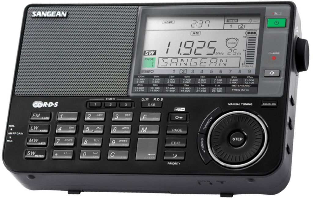
HF Weather Fax to Black Cat Systems is an application allowing you to decode facsimile weather maps on an iPad, an iPhone or Android device. The analysis and forecast maps are provided by radio stations around the World. Broadcast on shortwave, they can easily be received by BLU receivers as found in boating catalogs.
Read more …
Receive graphic weather maps on iPad [Update]
Weather analysis and forecasting maps developed by the NOAA (USA) and the Met Office (UK) cover vast areas over the Wold. They can be obtained sending a request by email to the weather server of british company MailaSail. With the latter, many maps are available in a listing (¹) in which it suffices to click on the links to load the request in a message ready to send. Read more …


